On this page:
Latest information about where, when and why environmental water may be delivered to the Snowy River and the environmental objectives being targeted is available in this year’s seasonal watering plan.
The seasonal watering plan also contains information about how environmental flows could support cultural, social, recreational and economic values in the Snowy River.
Watering data for the Snowy River and the wider Gippsland region is updated quarterly. Visit current watering releases to find out more.
To find out the current environmental water entitlements held by the VEWH in the Snowy River visit our water holdings.
Waterway manager
East Gippsland Catchment Management Authority
New South Wales Department of Climate Change, Energy, the Environment and Water
Storage manager
Environmental Water Holders
Victorian Environmental Water Holder
New South Wales Department of Climate Change, Energy, the Environment and Water
Traditional Owners
Gunaikurnai Land and Waters Aboriginal Corporation holds native title, has a Recognition and Settlement Agreement with the Victorian Government, and is the statutory authority for the management of Aboriginal heritage values and culture, under the Victorian Aboriginal Heritage Act 2006 in East Gippsland, including the lower Snowy River.
Traditional Owners with links to the Snowy River system also include Ngarigo and Bidawal peoples.
System overview
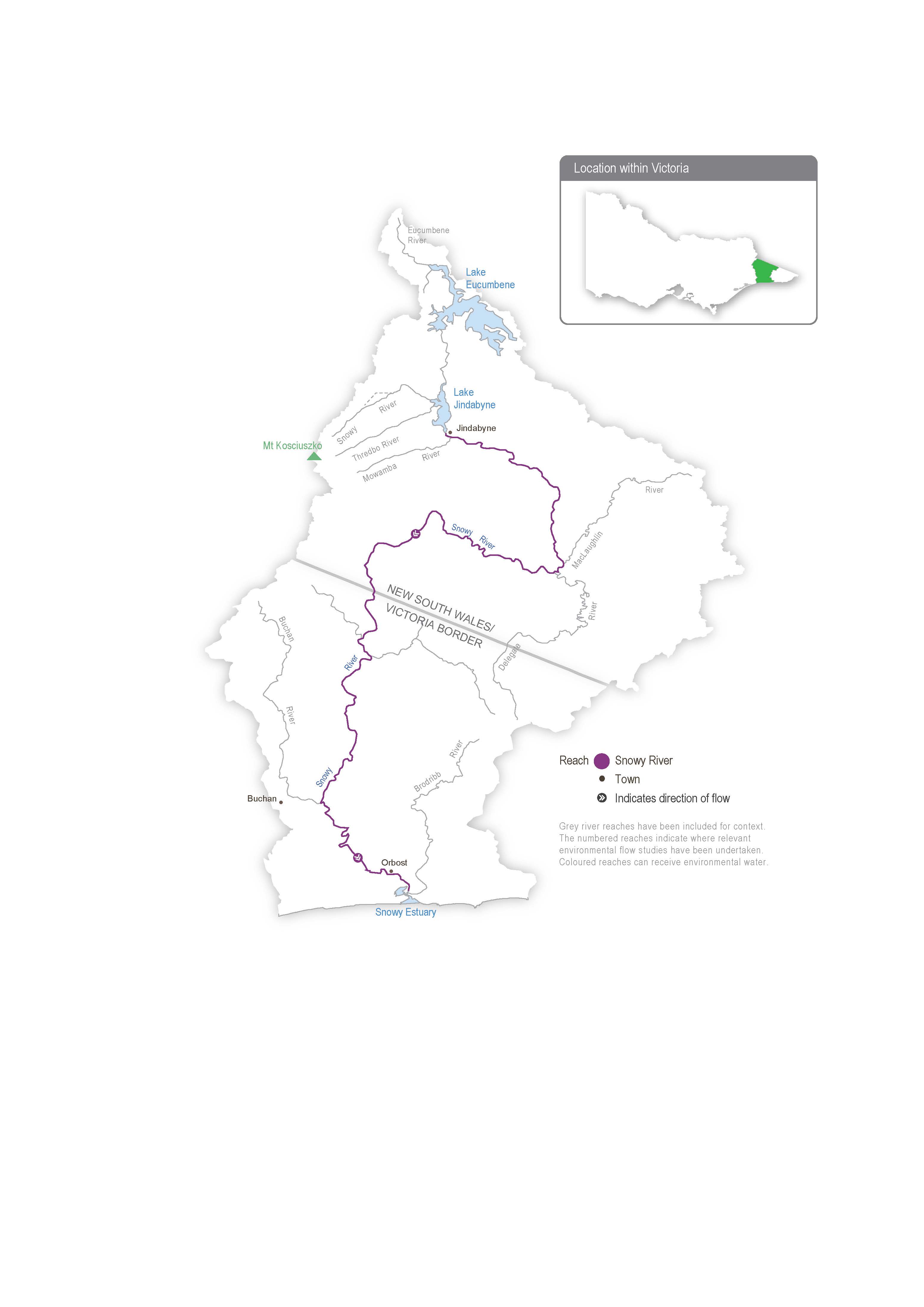
The Snowy River originates on the slopes of Mount Kosciuszko. It flows from its headwaters on the eastern slopes of the Snowy Mountains in New South Wales through the Snowy River National Park in Victoria and into Bass Strait.
Four major dams and multiple diversion weirs in the upper Snowy River catchment capture and divert water to the Murrumbidgee and Murray River valleys. The hydrological effects of the Snowy Mountains Scheme are substantial, but they are partly alleviated by the contribution of flows from tributaries (such as the Delegate River in NSW and the Buchan and Brodribb rivers in Victoria).
The construction and operation of the Snowy Mountains Hydro-electric Scheme previously diverted 99 per cent of the Snowy River’s mean annual natural flow at Jindabyne. The loss of flow changed the structure and function of the river, reduced the opening of the Snowy River entrance to Bass Strait and resulted in a decline in environmental values.
The Victorian, NSW and Commonwealth governments agreed to recover some water and, in 2002, delivered the first environmental flow to the Snowy River below Jindabyne Dam to help restore the damage done by decades of limited flow. The Victorian share of water for the environment available for use in the Snowy system is held in the Victorian Murray, Goulburn and Loddon systems. The NSW share of water for the environment available for use in the Snowy system is held in the NSW Murray and Murrumbidgee systems. Collectively, the water is made available for environmental flows in the Snowy River via a substitution method, whereby water for the environment allocated in Victoria and NSW replaces water earmarked for transfer from the Snowy to Victoria and NSW to support irrigation demands. The NSW Department of Climate Change, Energy, the Environment and Water plans environmental flows in the Snowy River in consultation with the Snowy Advisory Committee. The committee includes representatives of the Aboriginal community, the local community, the Victorian Government, the NSW Government and environmental experts. The committee brings together local knowledge and expert advice to help inform the management and delivery of water for environmental outcomes.
The water year in the Snowy system runs from 1 May to 30 April, and the daily flow regime is planned in advance by the Snowy Advisory Committee. Water for the environment is released daily from Jindabyne Dam into the Snowy River. The annual allocation of water for the environment varies based on water availability, rainfall and inflows. Environmental releases aim to deliver an average of 212,000 ML per year, the equivalent of 21 per cent of the average annual natural flow before the construction of the Jindabyne Dam.
Environmental values
The upper reaches and tributaries of the Snowy River support water-dependent plants and animals, including freshwater native fish (such as river blackfish and Australian grayling), platypus and frogs. The lower reaches support estuary perch and Australian bass that move between saltwater and freshwater systems. The estuary contains estuarine and saltwater species (such as flathead and black bream). The floodplain wetlands of the Snowy River near Marlo provide feeding and breeding areas for wetland and migratory birds.
Page last updated: 01/05/25
