On this page:
Latest information about where, when and why environmental water may be delivered to Birchs Creek and the environmental objectives being targeted is available in this year’s seasonal watering plan.
The seasonal watering plan also contains information about how environmental flows could support cultural, social, recreational and economic values in Birchs Creek.
Watering data for Birchs Creek and the wider northern region is updated quarterly. Visit current watering releases to find out more.
To find out the current environmental water entitlements held by the VEWH in Birchs Creek visit our water holdings.
Information about the ownership of water entitlements in Birchs Creek can be found under the Entitlements and Compliance section of the Loddon basin page at Victorian Water Accounts.
Waterway manager
North Central Catchment Management Authority
Storage manager
Environmental Water Holders
Victorian Environmental Water Holder
Commonwealth Environmental Water Holder
Traditional Owners
Dja Dja Wurrung Clans Aboriginal Corporation has a Recognition and Settlement Agreement with the Victorian Government and is the statutory authority for the management of Aboriginal heritage values and culture, under the Victorian Aboriginal Heritage Act 2006.
System overview
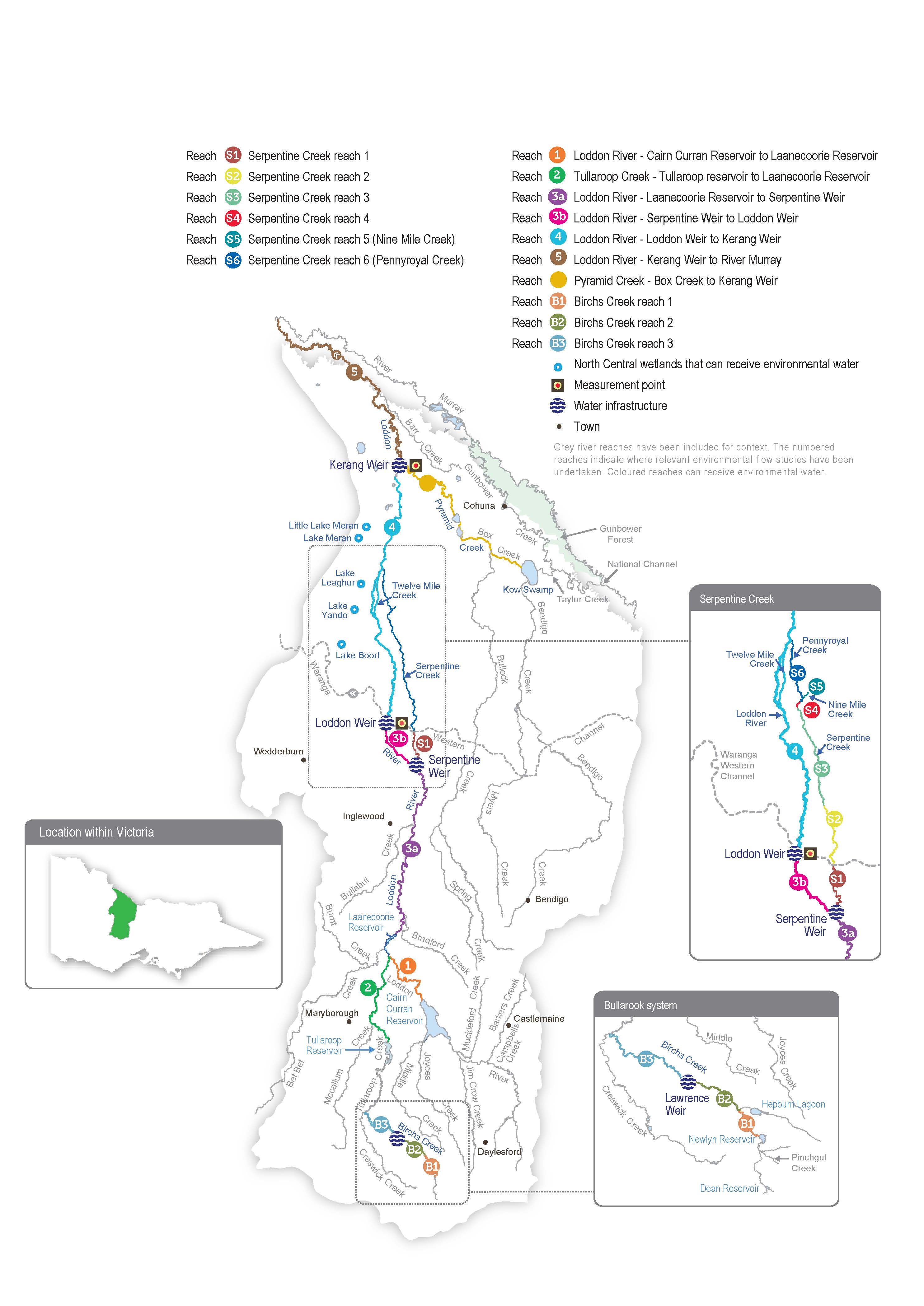
Birchs Creek is a tributary of the Loddon River located in the southernmost part of the catchment. The creek rises in the ranges northeast of Ballarat and flows northwest through Newlyn and Smeaton before joining Tullaroop Creek near Clunes. The lower parts of the catchment are extensively cleared, where the creek meanders through an incised basaltic valley. The creek contains a regionally significant platypus community and a vulnerable river blackfish population.
Birchs Creek is part of the broader Bullarook system, which contains two small storages — Newlyn Reservoir and Hepburn Lagoon — that provide water for irrigation and urban supply. The storages fill and spill during winter or spring in years with average or above-average rainfall. The VEWH holds water for the environment in Newlyn Reservoir but none in Hepburn Lagoon.
Birchs Creek receives tributary inflows from Rocky Lead, Langdons, Lawrence and Tourello creeks. Groundwater provides reliable baseflows to the downstream reaches of Birchs Creek in most years.
The VEWH is allocated 100 ML in Newlyn Reservoir on 1 December each year, provided that seasonal determinations in the Bullarook system are at least 20 percent. Any unused allocation from 1 December can be carried over until 30 November of the following water year, but if Newlyn Reservoir spills from 1 July to 30 November, the volume held in carryover is lost. Any water remaining on 30 November is forfeited. When seasonal determinations are below 20 percent, the VEWH does not receive an allocation, and the system’s resources are used to protect essential human needs.
Environmental values
Birchs Creek supports threatened aquatic plants, and its deep pools provide habitat for aquatic animals during dry periods. The creek contains native fish, including regionally significant populations of river blackfish and mountain galaxias, as well as flat-headed gudgeon and Australian smelt. Recent monitoring indicates that platypus are present throughout the entire creek.
Page last updated: 01/05/25
