On this page:
Latest information about where, when and why environmental water may be delivered to the Goulburn wetlands and the environmental objectives being targeted is available in this year’s seasonal watering plan.
The seasonal watering plan also contains information about how environmental flows could support cultural, social, recreational and economic values in the Goulburn wetlands.
Watering data for the Goulburn wetlands and the wider northern region is updated quarterly. Visit current watering releases to find out more.
To find out the current environmental water entitlements held by the VEWH in the Goulburn wetlands visit our water holdings.
Information about the ownership of water entitlements in the Goulburn wetlands can be found under the Entitlements and Compliance section of the Goulburn basin page at Victorian Water Accounts.
Waterway managers
Goulburn Broken Catchment Management Authority
Melbourne Water
Storage manager
Environmental Water Holders
Victorian Environmental Water Holder (including the Living Murray program)
Commonwealth Environmental Water Holder
Traditional Owners
Taungurung Land and Waters Council (TLaWC) has a Recognition and Settlement Agreement with the Victorian Government and is the statutory authority for the management of Aboriginal heritage values and culture, under the Victorian Aboriginal Heritage Act 2006.
Yorta Yorta Nation Aboriginal Corporation (YYNAC) is a Registered Aboriginal Party under the Victorian Aboriginal Heritage Act 2006 and has statutory authority for the management of Aboriginal heritage values and culture, under the Victorian Aboriginal Heritage Act 2006.
System overview
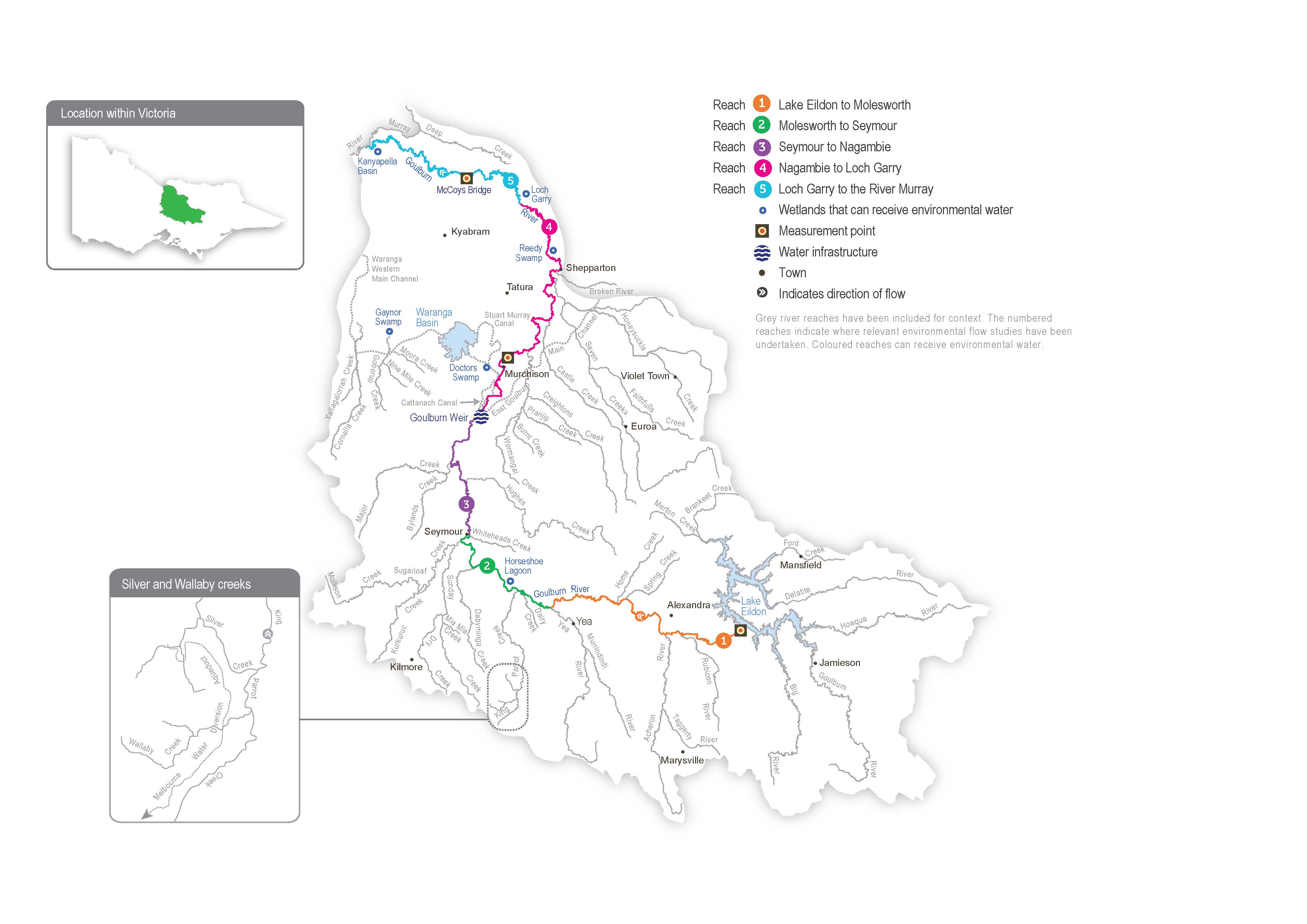
Within the Goulburn Broken catchment, there are about 2,000 natural wetlands identified, but only six — Doctors Swamp, Gaynor Swamp, Horseshoe Lagoon, Kanyapella Basin, Loch Garry and Reedy Swamp — have received water for the environment through the VEWH’s or CEWH’s entitlements. Several other small wetlands in the Goulburn catchment have been watered under a separate arrangement through the Murray-Darling Wetlands Working Group.
Doctors Swamp, Gaynor Swamp, Kanyapella Basin, Loch Garry and Reedy Swamp can receive water for the environment through irrigation supply infrastructure. The volume of water that can be delivered to each wetland depends on the physical capacity of the infrastructure and the seasonal allocation. Water for the environment can be delivered from the Goulburn River to Horseshoe Lagoon via a temporary pump.
Environmental values
Many natural wetlands across the Goulburn catchment, including Doctors Swamp, Gaynor Swamp, Kanyapella Basin, Loch Garry and Reedy Swamp, are formally recognised for their conservation significance. The Goulburn wetlands support various plant communities ranging from river red gum swamps to cane grass wetlands.
Doctors Swamp is one of Victoria’s most intact red gum swamps, supporting over 80 wetland plant species.
Gaynor Swamp is a cane grass wetland situated on paleosaline soils: soils formed from historic oceans. When wet, the wetland supports thousands of waterbirds, including brolga and intermediate egrets. Gaynor Swamp is more saline than other wetlands in the region when water levels are low, and it attracts a different group of feeding waterbirds as it draws down. The red-necked avocet is one of the most significant species that feed on exposed mudflats at Gaynor Swamp.
Horseshoe Lagoon is a paleochannel of the Goulburn River with tall marsh, floodway pond herbland and floodplain streamside woodland vegetation communities. The lagoon supports numerous waterbird species and is home to three turtle species, including the broad-shelled turtle.
Kanyapella Basin is a shallow freshwater marsh that provides habitat for numerous plant and animal species, including the threatened intermediate egret. Historically, it has been a popular breeding site for ibis, herons and cormorants.
Loch Garry is a paleochannel of the Goulburn River that provides deep open-water habitat. Shallow, vegetated wetland depressions, red gum forest and sand ridges surround the channel. It is an important site for waterbird feeding and roosting, and it is a drought refuge for eastern great egrets, musk ducks, nankeen night herons and royal spoonbills.
Reedy Swamp contains a mosaic of vegetation types, including tall marsh, floodway pond herbland and rushy riverine swamp. It is a vital drought refuge, nesting site for colonial waterbirds and stopover feeding site for migratory birds (such as sharp-tailed sandpiper and marsh sandpiper).
Page last updated: 01/05/25
