On this page:
Latest information about where, when and why environmental water may be delivered to the upper Murray wetlands and the environmental objectives being targeted is available in this year’s seasonal watering plan.
The seasonal watering plan also contains information about how environmental flows could support cultural, social, recreational and economic values in the upper Murray wetlands.
Watering data for the upper Murray wetlands and the wider northern region is updated quarterly. Visit current watering releases to find out more.
To find out the current environmental water entitlements held by the VEWH in the upper Murray wetlands visit our water holdings.
Information about the ownership of water entitlements in the upper Murray wetlands can be found under the Entitlements and Compliance section of the Murray basin page at Victorian Water Accounts.
The upper Murray wetlands are part of the Victorian Murray system.
Traditional Owners
Traditional Owners with links to the upper Murray wetlands region include the Dhudhuroa and Waywurru Nations and those represented by the Dalka Warra Mittung Aboriginal Corporation and the Duduroa Dhargal Aboriginal Corporation.
System overview
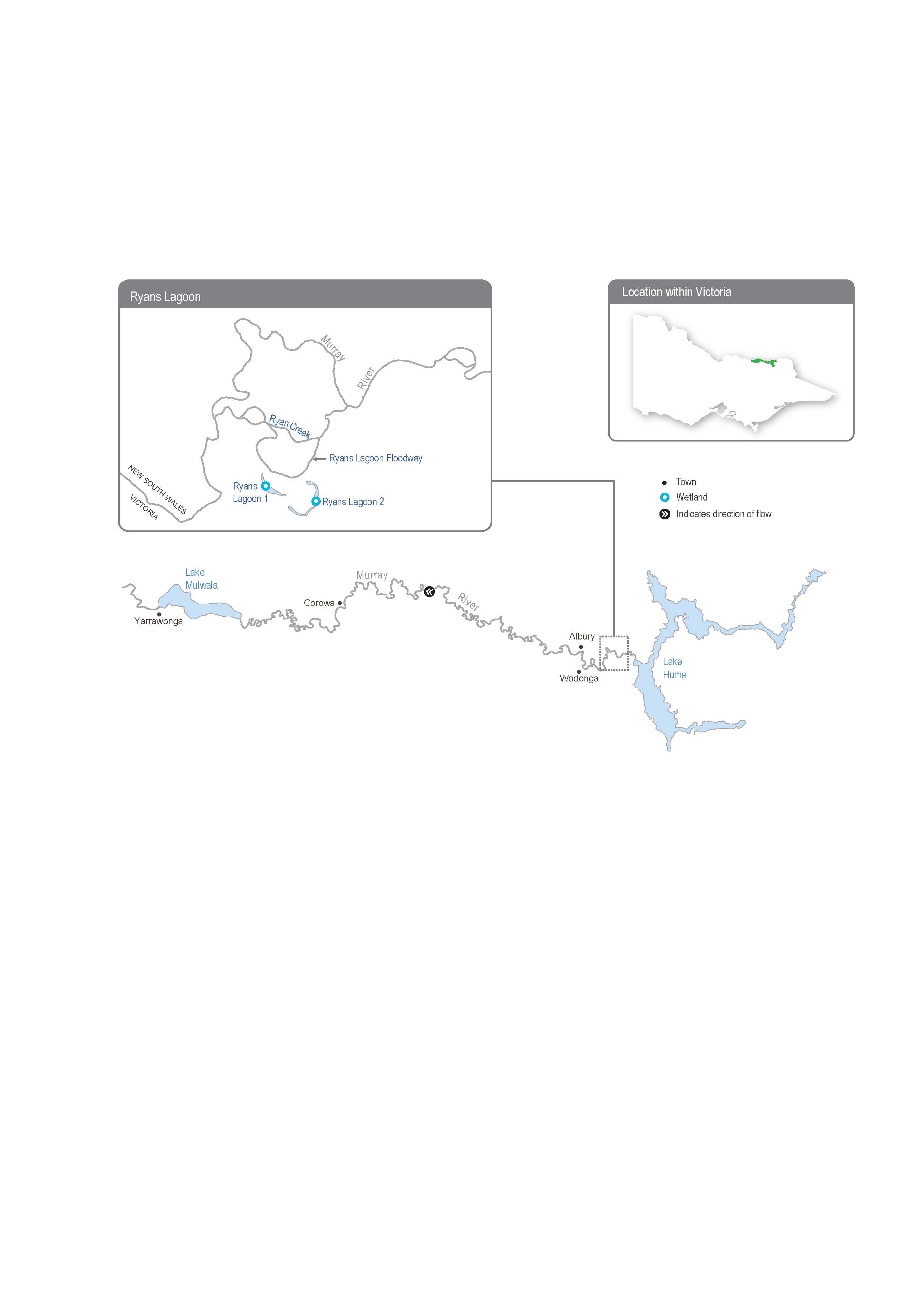
The upper Murray wetlands are on the Murray River floodplain between Lake Hume and Lake Mulwala. The wetland system includes the Ryans Lagoon wetland complex, which has two main lagoons: Ryans Lagoon 1 and Ryans Lagoon 2.
The Ryans Lagoon wetland complex is a network of wetlands positioned downstream of Lake Hume and upstream of the Kiewa River confluence with the Murray River.
Flows into the complex are mainly influenced by regulated releases from Lake Hume, which travel via Ryans Creek, an anabranch of the Murray River. The complex begins to fill from Ryans Lagoon Floodway through a culvert when the flow in the Murray River at the Heywoods gauge immediately below Lake Hume exceeds 24,000 ML per day, but sustained flows above 25,000 ML per day are needed to fill both lagoons completely.
It is proposed to use temporary pumps to deliver water for the environment to restore the ecological health of the complex by providing a wetting and drying regime closer to the natural flow regime that existed before the Murray River was regulated. Water can be pumped into Ryans Lagoon 2 from the Ryans Lagoon Floodway when the flow in the Murray River exceeds 20,000 ML per day and fills the floodway to a suitable depth for the pumps to operate.
Victoria, NSW and other stakeholders have been exploring the feasibility of a coordinated spring pulse for the Hume-to-Yarrawonga reach of the Murray, which may fill Ryans Floodway to a sufficient height and duration for pumping.
The North East CMA is investigating options to improve watering regimes at other wetlands along the upper Murray floodplain.
Environmental values
The North East CMA’s North East Waterway Strategy recognises the Ryans Lagoon wetland complex as a high-value wetland system, and it is listed as a nationally significant wetland in the Directory of Important Wetlands in Australia. The complex provides habitat for seven bird, three fish, one frog and one perennial plant species listed under the Commonwealth Environmental Protection and Biodiversity Conservation Act 1999 and/or the Victorian Flora and Fauna Guarantee Act 1988. Ecological surveys conducted at the site since 1975 have recorded 250 species of waterbugs and 29 species of waterbirds, including the Australian white ibis, great egret and rufous night heron. The complex also supports native wetland vegetation communities expected to benefit from a seasonally aligned, more variable watering regime.
Page last updated: 01/05/25
