For the first time in over a century, native fish will be able to move freely between the Murray River and Gunbower Creek with the launch of two new fishways at Koondrook and Cohuna in northern central Victoria.
Fishways are major pieces of infrastructure designed to enable fish to swim upstream around weirs and dams. For fish populations to become healthy and sustainable, they need to be able to migrate upstream and downstream to access key habitat and feeding ground. Dams and weirs prevent this from happening.
The new fishways connect 140 kilometres of Gunbower Creek to 530 kilometres of open Murray River. This will dramatically improve the ability of fish populations to feed and breed in prime fish habitat over a large area, supporting the resilience and diversity of various native species including the golden perch and Murray cod.
The fishways are part of North Central CMA’s Native Fish Recovery Plan – Gunbower and lower Loddon, which involves the large-scale, long-term and holistic rehabilitation of the network of creeks, lagoons, wetlands and floodplains.
VEWH made an important decision to sell water to fund the Koondrook fishway
In a significant milestone for the VEWH, almost $5.4 million of funding for the Koondrook fishway design and construction was secured through the sale of some of its water allocation in northern Victoria. It is the largest individual project the VEWH has ever funded.
Parliamentary Secretary for Water Harriet Shing officially opened the Koondrook fishway on 9 December 2021.
Speaking at the event, VEWH Co-CEO, Dr Sarina Loo highlighted the importance of investing in infrastructure that can provide long-term benefits by enhancing environmental watering outcomes.
“The weir presented a significant barrier to native fish feeding, migration and breeding along Gunbower Creek, and their connection with more than 500km of the Murray River,” she said.
“After conducting an assessment to ensure that all priority watering actions planned for dry conditions could be achieved for the 2018-19 watering year, and that there was enough unused water available for carry over into 2019-20 for critical watering, we decided to sell 10,000 ML from the Murray System.
“Using the proceeds from the sale to fund the Koondrook fishway ensured our environmental water allocations were used effectively and efficiently based on a well-informed objective with enduring benefits for the environment and the community,” she said.
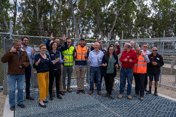
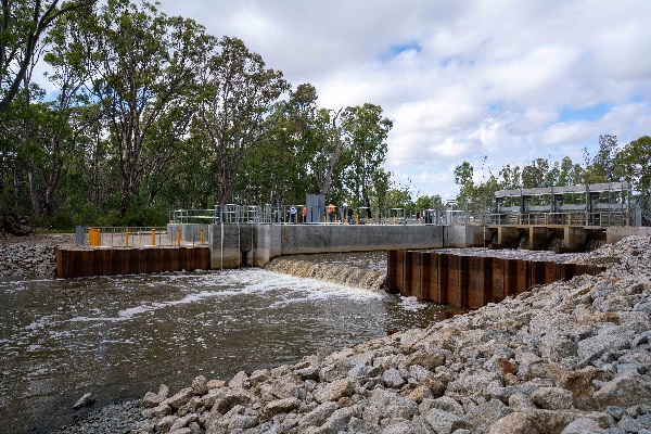
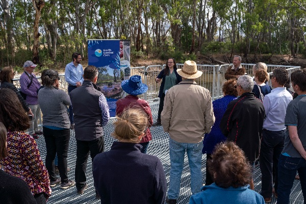
The Koondrook Fishway (centre), the result of work by the North Central Catchment Management Authority, Goulburn-Murray Water and S&R Engineering and Construction, was launched on 9 December 2021, by the Parliamentary Secretary for Water, Ms Harriet Shing. The fishway is part of the North Central CMA’s Native Fish Recovery Plan, which aims to create a world-class native fishery in the region. Photos courtesy of North Central CMA.
Traditional Owner consultation in developing the fishway
These works were developed on Barapa Barapa country.
Barapa Barapa nation were engaged in the concept, detailed design and ‘Construction Cultural Heritage’ induction for the project.
They were also involved in observing major ground disturbance works, and invited to provide their perspective at events including tours for various important stakeholders in the project.
Toward the end of the project they also helped complete the revegetation at the site.
Outcomes of water the environment in Gunbower Creek to date
VEWH and the North Central CMA have delivered water for the environment down Gunbower Creek since 2013-14. Deliveries have been carefully planned to provide the right flows to support the breeding and survival of native fish, especially Murray cod.
Growth of the Murray cod populations in the creek was scarcely recorded prior to the introduction of water for the environment but has been detected in each year since the flows have been managed.
Murray cod need stable flows and will abandon their nests if water levels fluctuate. Water for the environment stabilises flows during irrigation season and provides a protective base flow over winter.
Flows in the creek include a steady spring flow to keep Murray cod on their nests, flows that target the inundation of high-quality habitat, and a base flow over winter to provide habitat for juvenile cod and other native fish species.
Water for the environment is also delivered to the Gunbower Forest floodplain which borders Gunbower Creek. The flows not only maintain the health of this iconic red gum forest, but also provide vital food and nutrients to native fish by returning water from the floodplain back into Gunbower Creek and the Murray River in spring when the fish needed it most.
Managing the efficient delivery of water for the environment for Gunbower
The Southern Connected Basin Environmental Watering Committee coordinates flows throughout the Murray system, including environmental watering at Gunbower Creek and Gunbower Forest using water held by the VEWH, the Living Murray program and the Commonwealth Environmental Water Holder. Some of the water for the environment allocation that has been delivered to target environmental outcomes upstream in the Goulburn River, Lower Broken Creek and at Barmah Forest continues to flow downstream and is re-used at Gunbower Creek and Gunbower Forest.
In 2020-21, 73 percent of environmental flows delivered in northern Victoria were re-used to meet downstream environmental water needs. To further increase the efficient use of environmental water in Gunbower Creek, the environmental flows are achieved through the delivery of the operational water delivered for towns and farms. Any water consumed by the environment, not towns or farms, is then covered by environmental water holders.
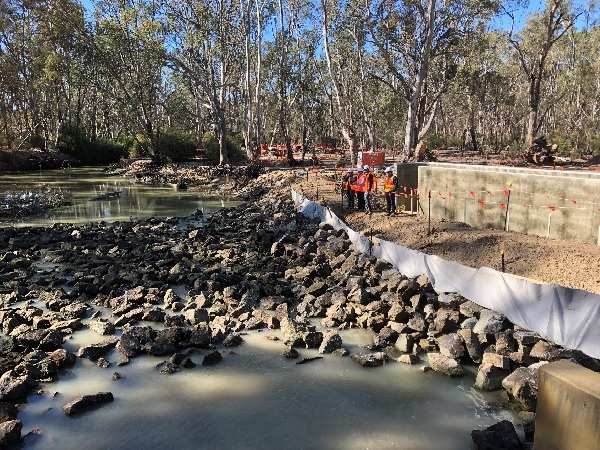
Koondrook weir fishway construction
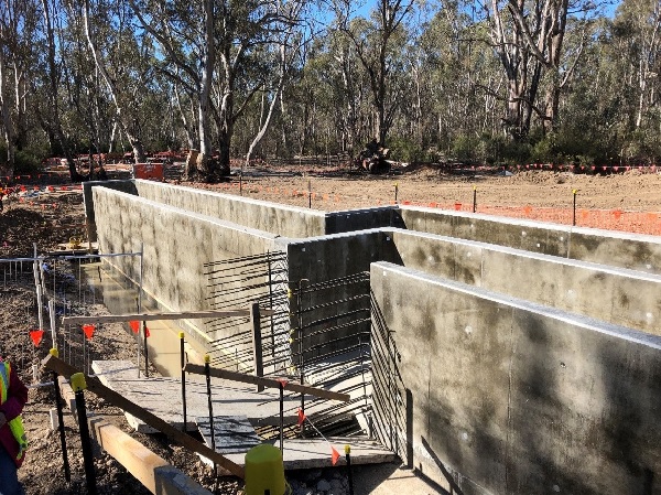
Koondrook weir fishway construction
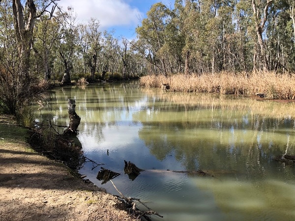
Gunbower Creek
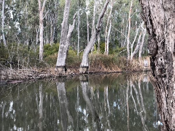
Gunbower Creek